
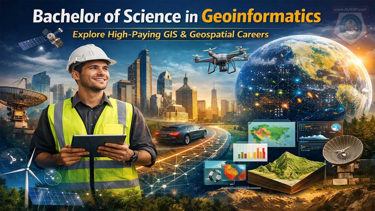
A Bachelor of Science in Geoinformatics (BScGeoInfo) is a technology-driven degree that combines geography, computer science, mathematics, and data analysis to turn location-based data into actionable insights, preparing graduates for high-demand roles across government, technology, environmental science, urban planning, defense, and consulting.
As global reliance on spatial data grows, the geoinformatics job market is expanding rapidly, with salaries ranging from about $54,000 at entry level to $110,000+ in advanced and managerial roles, especially for professionals with strong programming (Python, SQL), cloud, and remote sensing skills.
The curriculum blends GIS, remote sensing, GPS, spatial analysis, programming, databases, and fieldwork, offering both theoretical foundations and hands-on experience. With strong ROI, global career mobility, and applications in critical areas like climate change, smart cities, autonomous vehicles, and infrastructure planning, a geoinformatics degree offers long-term career stability, flexibility across industries, and significant earning potential for graduates who continuously build technical expertise.
| Aspect | Information |
|---|---|
| Degree | Bachelor of Science in Geoinformatics (BSc GeoInfo) |
| Focus | GIS, spatial data analysis, remote sensing, programming |
| Core Skills | GIS (ArcGIS/QGIS), Python, SQL, Remote Sensing, GPS |
| Duration | 3–4 years |
| Entry Salary | ~$54,000–$65,000/year |
| Mid-Career Salary | ~$75,000–$95,000/year |
| Senior Salary | $100,000–$165,000+/year |
| Top Roles | GIS Analyst, GIS Developer, Geospatial Manager |
| Key Industries | Tech, Government, Environment, Telecom, Urban Planning |
| Global Demand | High and growing through 2030 |
| Best ROI Regions | Germany (low tuition), USA (high salaries) |
| Career Advantage | Strong mix of geography + coding + data science |
Bachelor of Science in Geoinformatics: A Complete Career Guide to High-Paying GIS Opportunities
The world is increasingly reliant on location-based data. Every smartphone navigation app, climate prediction model, urban planning decision, and disaster response initiative depends on experts who understand how to collect, analyze, and visualize geographic information.
If you’re considering a Bachelor of Science in Geoinformatics (BScGeoInfo), you’re entering one of the fastest-growing technical fields in the 21st century—where salaries range from $54,000 to over $110,000 annually, depending on specialization and location.
This comprehensive AUBSP guide explores what geoinformatics is, why employers urgently need these professionals, what you’ll learn, real career pathways, and how this degree positions you for both job security and substantial earning potential across the globe.
What Is Geoinformatics? Understanding the Degree
Geoinformatics (also called Geographic Information Science or GIS) is an interdisciplinary science that combines geography, computer science, mathematics, and surveying to understand and solve problems using location-based data. A Bachelor of Science in Geoinformatics teaches students to transform raw geographic data into actionable intelligence.
The degree differs from traditional geography programs because it emphasizes the technology and computational methods—not just environmental or cultural analysis. Geoinformatics graduates become fluent in software platforms, database systems, and analytical frameworks that power everything from environmental monitoring to autonomous vehicles.
Why the Name “Geoinformatics”?
The term reflects the field’s three core elements:
- Geo = Earth and spatial location
- Informatics = Information science and technology
- Combined = Using technology to understand spatial patterns and relationships
This is why geoinformatics sits at the intersection of multiple industries: technology companies, government agencies, environmental organizations, and consulting firms all employ these professionals.
The Global Geoinformatics Market: Why This Degree Matters in 2026
The urgency for geoinformatics professionals has never been higher:
Market Growth & Opportunity
The global GIS market reached $17.5 billion in 2023 and continues expanding. Employment for GIS specialists is expected to grow faster than the average across all occupations. The Bureau of Labor Statistics notes that over 250 universities worldwide now offer geoinformatics programs, reflecting the field’s maturation and mainstream adoption.
Why Companies Are Hiring
- Government agencies use GIS for infrastructure planning, disaster response, and public safety
- Tech giants (Google, Apple, Amazon) integrate location services across products
- Environmental organizations monitor climate change, deforestation, and water resources
- Telecommunications companies optimize network coverage using spatial analysis
- Real estate and urban development firms use GIS for site selection and planning
- Defense and intelligence sectors rely on geospatial analysis
- Autonomous vehicle companies depend on precise mapping and location intelligence
This diverse demand means geoinformatics graduates find employment across virtually every industry sector.
Bachelor of Science in Geoinformatics: Typical Curriculum
A typical BScGeoInfo program spans 3–4 years and combines theory with hands-on technical training. Here’s what you’ll study:
Core Geoinformatics Modules
- Geographic Information Systems (GIS) Fundamentals: Database design, spatial data structures, map projections, and coordinate systems
- Remote Sensing: Satellite and aerial image acquisition, interpretation, and processing for land-use monitoring, climate analysis, and resource management
- Global Positioning Systems (GPS): Satellite positioning, survey methodology, and accuracy assessment
- Cartography & Map Design: Principles of effective map creation, data visualization, and geovisualization techniques
- Spatial Analysis & Geostatistics: Statistical methods for analyzing spatial patterns, interpolation, and predictive modeling
- Photogrammetry: 3D data extraction from images, LiDAR processing, and point cloud analysis
Technical & Programming Skills
- Programming Languages: Python (most in-demand), SQL, R, and JavaScript
- GIS Software Platforms: ArcGIS (industry standard), QGIS (open-source), ENVI, and specialized remote sensing tools
- Database Management: Relational databases, spatial databases, and data warehousing
- Web Mapping: Building interactive maps using web technologies
- Cloud Platforms: AWS and Google Earth Engine for processing large-scale geospatial data
Supporting Disciplines
- Mathematics: Differential geometry, linear algebra, and calculus
- Computer Science: Data structures, algorithms, and software development
- Physics: Fundamental concepts for understanding remote sensing sensors
- Geography: Physical geography, human geography, and applied geographic methods
- Surveying & Geodesy: Land surveying, coordinate systems, and Earth measurement
Fieldwork & Capstone Projects
Most programs include:
- GPS field surveys and measurements
- Drone/aerial data collection
- Remote sensing image analysis projects
- Real-world GIS problem-solving capstone projects
- Internships in government, tech, or environmental sectors
Top Global Universities Offering BScGeoInfo Degrees
If you’re planning to study abroad or seeking internationally recognized credentials:
| University | Location | Program Name | Tuition/Year | Ranking |
|---|---|---|---|---|
| Karlsruhe Institute of Technology | Germany | B.Sc. Geodesy and Geoinformatics | €1,500 | #166 (THE) |
| University of Oxford | UK | Geography (GIS specialty available) | ~£28K | Top 1 |
| University of Maryland | USA | GIS & Remote Sensing | ~$35K | Tier 1 |
| Saint Louis University | USA | B.S. Geoinformatics & Geospatial Analytics | ~$42K | Specialized |
| National University of Singapore | Singapore | MSc Applied GIS | Variable | Tier 1 |
| University of Stuttgart | Germany | B.Sc./M.Sc. Geodesy & Geoinformatics | €3,000 | #251 (THE) |
| Leibniz University Hannover | Germany | M.Sc. Geoinformatics | €791 | #351 (THE) |
| Ulster University | Northern Ireland/UK | B.Sc. Civil Engineering & Geoinformatics | £17,490 | Tier 2 |
Affordability note: German universities charge significantly lower tuition (€791–€3,000/year) compared to UK (£17,490+) and US ($35,000+), making them attractive for international students.
Geoinformatics Careers: From Entry-Level to Six-Figure Roles
The beauty of a geoinformatics degree is its flexibility—graduates succeed across multiple career trajectories. Here’s the typical progression:
Career Pathway & Salary Progression
Entry-Level (0–2 years)
- GIS Technician: $51,490–$54,547/year
- Tasks: Data entry, map production, quality assurance
- Skills: GIS software, basic spatial analysis
Mid-Career (2–5 years)
- GIS Analyst: $63,000–$65,385/year
- Tasks: Spatial analysis, database management, client projects
- Skills: Advanced GIS, SQL, spatial statistics
- GIS Specialist: $68,000–$78,859/year
- Tasks: Specialized geospatial solutions, training, documentation
- Skills: Proficiency across multiple GIS platforms
Senior & Advanced Roles (5+ years)
- GIS Developer: $91,000–$100,464+/year
- Tasks: Custom application development, automation, cloud infrastructure
- Skills: Programming (Python, JavaScript), software architecture, cloud computing
- GIS Systems Administrator: $85,000–$95,000/year
- Tasks: Network infrastructure, database administration, system optimization
- Skills: IT infrastructure, cybersecurity, database optimization
- Geospatial Project Manager: $90,000–$110,000+/year
- Tasks: Client management, team leadership, strategic planning
- Skills: Leadership, technical knowledge, business acumen
- GIS Researcher/Academic: $80,000–$120,000+/year
- Tasks: Advanced research, publications, teaching
- Skills: Research methodology, domain expertise, advanced statistical analysis
Why Skills Drive Salary Growth
Research analyzing GIS job postings reveals a critical pattern: 43% of geoinformatics jobs don’t require a bachelor’s degree, but those requiring specialized technical skills command premium salaries. Here’s the breakdown:
| Skill Level | Typical Salary | Differentiator |
|---|---|---|
| Traditional GIS tools only (ArcGIS, QGIS) | $63,000 | Entry to mid-level |
| GIS + Python/SQL | $75,000–$85,000 | Competitive advantage |
| GIS + Python + Cloud (AWS/GCP) | $85,000–$100,000 | High demand |
| Advanced (coding + cloud + architecture) | $100,000–$165,000 | Leadership potential |
The takeaway: Geoinformatics graduates who develop programming skills—especially Python—see their salaries increase by 25–50% compared to peers using only traditional GIS software.
Critical Skills Employers Actually Want in 2026
If you’re choosing a geoinformatics program or planning your coursework, focus on developing these nine in-demand skills:
1. Python Programming
Python is the most-requested coding language in geoinformatics roles. It’s used to automate tasks, extend ArcGIS and QGIS, perform spatial analysis, and build custom applications. Proficiency here separates $65K analysts from $91K developers.
2. Spatial SQL & Database Management
Working with massive geospatial datasets requires fluency in SQL and spatial databases (PostgreSQL with PostGIS, SQL Server, Oracle Spatial). This skill is increasingly essential as enterprises shift to cloud-based data infrastructures.
3. Cloud Technologies (AWS, Google Cloud, Azure)
One in five GIS job postings now demand cloud expertise. Skills in cloud platforms like AWS, Google Earth Engine, and Azure are gateway skills to $100K+ positions.
4. Esri Software Proficiency (ArcGIS)
ArcGIS appears in roughly 70% of job postings. Most employers expect Bachelor’s graduates to have hands-on ArcGIS experience. Complementary open-source knowledge (QGIS) is a bonus.
5. Remote Sensing & Satellite Imagery
Increasingly critical as companies use drones, satellite data, and LiDAR. Knowledge of image processing, classification algorithms, and tools like ENVI, Erdas Imagine, or Google Earth Engine is highly valued.
6. Data Analysis & Visualization
Beyond mapping, employers seek analysts who can extract insights from complex datasets. Tools like Tableau, Python libraries (GeoPandas, Folium), and R are essential for turning data into business decisions.
7. FME (Feature Manipulation Engine)
This ETL (Extract, Transform, Load) platform converts data between formats and automates workflows. Professionals with FME skills report salary increases of 3–4x compared to their starting positions.
8. Web Mapping & GIS Applications
Building web-based mapping solutions (Leaflet, Mapbox, ArcGIS REST APIs) opens opportunities in tech companies. JavaScript and web development knowledge is increasingly expected.
9. Coding & Automation Expertise
Entry-level positions face competition, but professionals who can write code, automate repetitive tasks, and architect solutions have a clear path to advancement and higher compensation.
Geoinformatics Industries: Where the Jobs Are
Geoinformatics graduates work across nearly every sector. Here are the top employers and typical responsibilities:
Government & Public Sector (54% of geographers work here)
- Urban and regional planning
- Infrastructure management
- Environmental monitoring
- Public health tracking
- Disaster response and emergency management
- Defense and intelligence analysis
Technology Companies
- Location services and mapping (Google Maps, Apple Maps)
- Autonomous vehicles and robotics
- IoT sensor networks and real-time location tracking
- Smart city infrastructure
- E-commerce logistics optimization
Environmental & Conservation Organizations
- Climate change monitoring
- Deforestation tracking
- Biodiversity assessment
- Water resource management
- Carbon footprint analysis
Telecommunications
- Network coverage optimization
- Site selection for cell towers
- Service area planning
- Interference mapping
Real Estate & Urban Development
- Property valuation and site analysis
- Market analysis and demographic mapping
- Development suitability analysis
- Real estate investment analysis
Energy & Utilities
- Grid optimization
- Pipeline routing
- Renewable energy site assessment
- Infrastructure maintenance planning
Consulting & Professional Services
- Geospatial consulting for multinational clients
- Environmental impact assessments
- Engineering design and planning
- Business intelligence and market analysis
The Complete Admissions Guide: How to Get Into a Geoinformatics Program
Typical Admission Requirements
Academic Prerequisites:
- High school diploma or equivalent (secondary school completion)
- Strong background in mathematics (calculus, linear algebra)
- Physics or computer science helpful but not always required
- GPA typically 3.0+ for competitive programs
Standardized Tests:
- SAT, ACT (for US universities)
- IELTS 6.0–6.5 or TOEFL 79+ (for international students)
Application Materials:
- Transcripts from secondary school
- Letters of recommendation (usually 2–3)
- Personal statement explaining interest in geoinformatics
- Evidence of technical aptitude or prior GIS/programming experience (a plus)
Geographic Advantages
- Germany: Lowest tuition costs (€1,500–€3,000/year), excellent reputation, English-taught programs available
- US: Highest average salaries post-graduation ($78,859+), strong industry connections
- UK: Balance of prestige and cost (£17,490+), strong geographic tradition
- Singapore & Asia: Growing tech scene, lower costs than Western programs, opportunities in developing geospatial markets
- Australia & Canada: Strong programs, work-visa opportunities, good quality-of-life metrics
Scholarship & Funding Opportunities
- German government scholarships (DAAD) for international students
- University-specific merit scholarships
- Government sponsorship programs in your home country
- Private sector sponsorships from GIS companies
Is a Geoinformatics Degree Worth It? Comparing ROI
Cost vs. Earning Potential
4-Year Program Costs (Estimated):
- Germany: €6,000–€12,000 total
- US: $140,000–$168,000 total
- UK: £70,000–£79,000+ total
Average Starting Salary: $54,000–$65,000
5-Year Career Salary Projection: $75,000–$95,000
10-Year Career Ceiling: $100,000–$165,000
ROI Timeline: Typically 4–6 years for full cost recovery, faster if you develop advanced technical skills.
Alternatives to Traditional 4-Year Degrees
- Online GIS Certificates: 3–12 months, $2,000–$5,000, entry-level positions only
- GIS Bootcamps: 12–16 weeks intensive, $10,000–$20,000, junior analyst roles
- Master’s Degrees: 1–2 years post-bachelor’s, positions in advanced research or management
- Self-Study + Certifications: Free–$3,000, limited to technical-only roles (requires strong self-discipline)
Verdict: The Bachelor’s degree provides the broadest career access and highest earning potential over 10+ years. The upfront investment is substantial but justified by career stability and salary trajectory.
Geoinformatics Job Market Outlook: Demand Trajectory Through 2030
Employment Growth Forecast
- Overall job growth: Expected to grow faster than average across all occupations
- GIS specialist positions: Steady expansion in both public and private sectors
- Geospatial technology roles: High growth, especially for cloud and AI-integrated positions
- Geographic information scientists: Increasing demand from enterprise sector and developing nations
Competitive Landscape
Entry-level GIS technician positions face significant competition in developed markets, but mid-career positions (analysts, developers) have moderate to strong demand. Competition is lower in:
- Developing nations with emerging geospatial infrastructure needs
- Tech companies expanding location services
- Environmental and climate tech startups
Future-Proofing Your Career
To stay competitive through 2030:
- Develop programming expertise (especially Python)
- Stay current with cloud platforms (AWS, Google Cloud)
- Understand AI/ML applications in geospatial analysis
- Pursue advanced specializations (remote sensing, 3D modeling, IoT sensors)
- Build a professional network within the geospatial community
- Consider a Master’s degree for leadership roles
Real Career Stories: What Geoinformatics Graduates Actually Do
Case Study 1: From GIS Technician to Developer (5-Year Trajectory)
“I started as a GIS technician at a local government planning office earning $51,000. After two years, I enrolled in evening Python courses while working full-time. Within three years of becoming a GIS analyst ($65,000), I learned FME and JavaScript. This expanded skillset got me noticed by a tech company, where I now work as a geospatial software developer earning $95,000. The key? I didn’t stop learning after my degree.”
Case Study 2: Environmental NGO to Remote Sensing Specialist
“My geoinformatics degree prepared me well for environmental conservation work. I started at an NGO tracking deforestation using satellite imagery ($60,000). After publishing research on machine learning for forest monitoring, I was recruited by a climate tech startup as a Remote Sensing Specialist ($85,000). Geoinformatics gave me both the technical foundation and the domain knowledge employers in climate tech desperately need.”
Case Study 3: Consultant to GIS Project Manager
“I worked at a geospatial consulting firm for six years, moving from analyst ($65,000) to senior consultant ($82,000). The skills I learned—client management, technical expertise, project delivery—positioned me perfectly for a GIS Project Manager role at a multinational firm ($105,000). Consulting taught me that geoinformatics is really about solving business problems, not just making maps.”
GeoinformaticsVs. Related Degrees: Making the Right Choice
If you’re considering multiple programs, here’s how geoinformatics compares:
| Degree | Focus | Best For | Avg. Salary |
|---|---|---|---|
| Geoinformatics | Technology + geography + spatial analysis | Tech-oriented problem solvers, entrepreneurs | $65K–$91K+ |
| Geography | Theory, human/physical systems, field research | Academics, environmental consultants, educators | $60K–$76K+ |
| GIS Diploma/Certificate | Software skills only, narrow focus | Budget-conscious, quick entry | $50K–$60K |
| Computer Science | Programming and algorithms | General software engineers, not geographic-specific | $70K–$95K (but less geospatial opportunity) |
| Environmental Science | Environmental focus with some GIS | Environmental consultants, policy advisors | $55K–$75K |
| Civil Engineering | Infrastructure and surveying | Civil engineers, land surveyors | $65K–$85K |
| Urban Planning | City design and policy | Urban planners, consultants | $60K–$80K |
Geoinformatics wins for: Flexibility across industries, tech-focused careers, earning potential, and job market demand.
Essential Resources & Tools You’ll Use in Your Degree
Most geoinformatics programs introduce you to industry-standard software. Understanding these tools before starting can accelerate your learning:
GIS Software (Free or included in coursework)
- ArcGIS (industry standard, often available through university licenses)
- QGIS (open-source, free, widely used)
- ArcGIS Online (cloud-based GIS)
Remote Sensing Software
- Google Earth Engine (free, cloud-based analysis)
- ENVI (paid, professional remote sensing)
- Erdas Imagine (paid, image processing)
- Orfeo Toolbox (open-source)
Programming & Scripting
- Python (free, essential)
- R (free, statistical analysis)
- SQL (database language)
- JavaScript (web mapping)
Database Platforms
- PostgreSQL + PostGIS (free, spatial database)
- SQLite (free, lightweight)
- Oracle Spatial (enterprise)
Web Mapping Libraries
- Leaflet (free, open-source)
- Mapbox (free tier available)
- ArcGIS REST APIs (integrated with ArcGIS)
Data Sources (mostly free)
- Google Earth and Google Earth Engine
- USGS Earth Explorer (free satellite data)
- Copernicus (free ESA satellite data)
- OpenStreetMap (free geographic data)
- Natural Earth (free geographic data)
Mistakes to Avoid When Choosing a Geoinformatics Program
- Choosing based on prestige alone: While top-tier universities have advantages, strong regional programs often provide better job placement and hands-on experience. Employer recognition matters more than rankings.
- Ignoring programming education: A geoinformatics degree without strong programming preparation will limit your earning potential. Ensure the curriculum includes substantial Python and SQL components.
- Overlooking practical experience: Look for programs with internship partnerships, capstone projects, and field schools. Hands-on experience accelerates job readiness.
- Focusing exclusively on traditional GIS software: While ArcGIS proficiency is important, overemphasis on this single tool limits your adaptability. Prefer programs teaching open-source alternatives and cloud platforms too.
- Not considering geographic location of the program: Your university’s location affects internship opportunities, industry partnerships, and post-graduation job markets. Program location matters.
- Overlooking career services: Check whether the program has strong alumni networks, internship pipelines, and career counseling. These soft advantages directly impact employment outcomes.
- Skipping interdisciplinary breadth: The best geoinformatics graduates understand applications across multiple domains. Choose programs offering electives in environmental science, urban planning, engineering, or business.
Getting Started: Your Action Plan Today
If You Haven’t Started Your Degree Yet
- Research program specializations (remote sensing vs. GIS development vs. cartography)
- Strengthen your math and computer science skills now
- Take free online GIS courses (Coursera, edX) to confirm your interest
- Join online GIS communities (Reddit r/GIS, GIS StackExchange) to ask professionals about career paths
- Identify universities that match your budget and location preferences
- Prepare strong application materials emphasizing technical aptitude
If You’re Currently Enrolled
- Develop programming skills beyond the curriculum (Python on your own)
- Seek internships in your second/third year to build professional experience
- Join the student GIS club or mapping projects
- Learn cloud platforms (AWS, Google Earth Engine) through free tier accounts
- Contribute to open-source GIS projects (GitHub) to build your portfolio
- Network with professors and industry professionals
If You’ve Graduated
- Consider a Master’s degree if targeting senior or specialized roles
- Pursue relevant certifications (Esri, Google, AWS)
- Develop a geospatial project portfolio (GitHub, personal website)
- Engage with professional organizations (ASPRS, AAG, Esri User Conferences)
- Consider specialization in emerging areas (AI/ML for geospatial, drone mapping, 3D GIS)
- Stay current with industry trends and new tools
Why Geoinformatics Matters More Than Ever
We live in an era where location is everything. Climate change requires geographic analysis. Autonomous vehicles need precise mapping. Urban planners must optimize cities for 8+ billion people. Companies use location data to understand consumer behavior. Defense systems depend on geospatial intelligence. Renewable energy projects require site analysis.
A Bachelor of Science in Geoinformatics isn’t just a degree in “making maps”—it’s a degree in understanding and solving the world’s most pressing spatial problems using cutting-edge technology. Graduates enter a field with strong job security, competitive salaries ($65,000–$91,000 average for mid-career professionals), clear advancement pathways, and the satisfaction of knowing their work impacts climate, urban development, and global challenges.
The field is growing. Employers are hiring. Salaries are rising, especially for those who combine GIS expertise with programming skills. And the variety of career paths means your geoinformatics degree can lead virtually anywhere you want to go.
If you’re analytical, curious about how geography and technology intersect, and want to build a career solving real-world problems using spatial data, a geoinformatics degree may be exactly what you’re looking for.
Additional Resources for Further Learning
- Professional Organizations: ASPRS (American Society for Photogrammetry and Remote Sensing), AAG (Association of American Geographers), Esri User Community
- Free Learning Platforms: Coursera, edX, Udemy, YouTube (search “GIS tutorials,” “Python for geospatial”)
- Communities: Reddit r/gis, GIS StackExchange, GIS.SE
- Industry News: GIS Lounge, GeoAwesome, CityLab
- Job Boards: LinkedIn (filter by GIS), Indeed (search “geoinformatics”), Esri Job Board
- Salaries & Career Data: PayScale, Glassdoor, Bureau of Labor Statistics, ZipRecruiter
FAQ: Common Questions About Geoinformatics Degrees
Q: Do I need to be good at mathematics for geoinformatics?
A: Yes, strong math skills (calculus, linear algebra) are important. However, most concepts are taught in the curriculum, so you don’t need advanced mathematics before enrolling.
Q: Can I work internationally with a geoinformatics degree?
A: Absolutely. The degree is recognized globally, and demand is strong across North America, Europe, and Asia. Consider where you want to work before choosing a university.
Q: How quickly can I find a job after graduation?
A: Most graduates find positions within 3–6 months. Internship experience significantly accelerates job placement.
Q: Is a Master’s degree necessary for good salaries?
A: Not necessarily. Strong technical skills (programming, cloud platforms) from your Bachelor’s can lead to $80K–$90K+ roles. A Master’s is more valuable for academic or specialized research positions.
Q: What if I’m already working? Can I study geoinformatics part-time?
A: Many universities offer evening and online options. Some programs are available fully online (though field-based coursework is limited). Check specific universities for flexible scheduling.
Q: Is geoinformatics a stable career?
A: Yes. Growing demand, diverse industry applications, and increasing reliance on spatial data make it more stable than many tech fields.
Leave a Reply
You must be logged in to post a comment.